


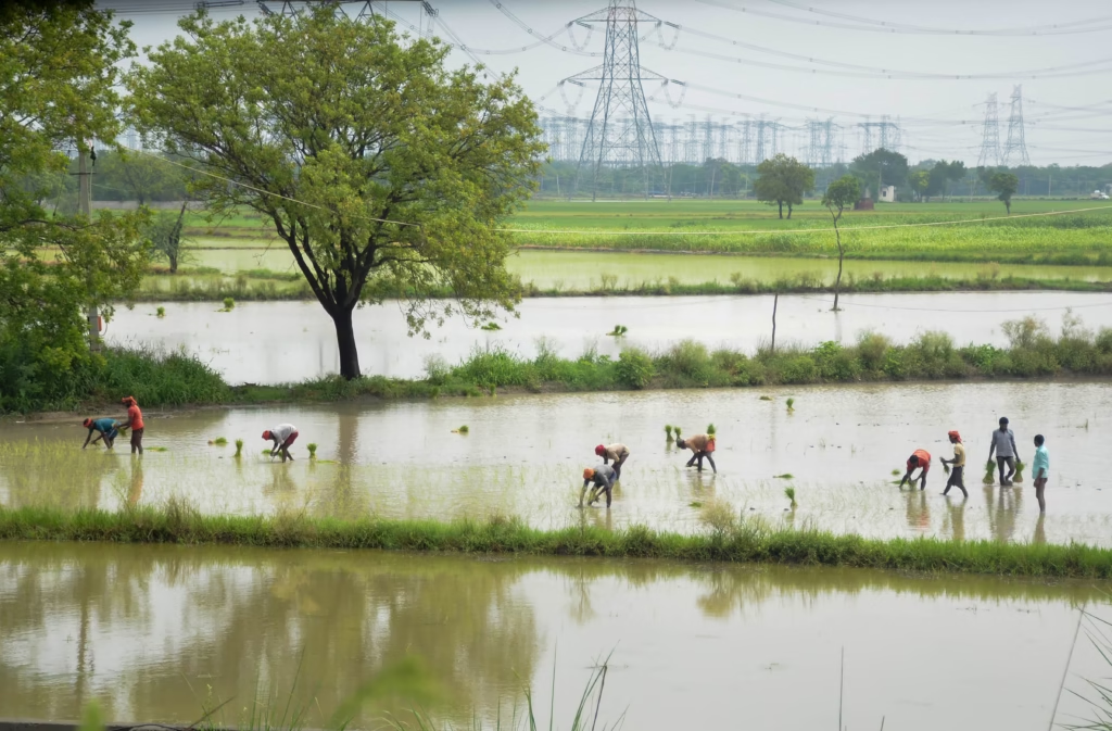
The Crop Submersion Assessment has commenced after agriculture officers began evaluating paddy fields affected by recent flash floods. The assessment aims to determine the extent of crop damage and provide an official understanding of the impact on agricultural land while authorities continue monitoring flood-affected areas.
Landslide Clearance Squads Placed on Standby Along Baramura Hill Ranges
Crop Submersion Assessment Launched Across Flood-Affected Paddy Fields
The Assessment began after agriculture officers initiated field inspections in areas where flash floods submerged paddy cultivation. According to the available information, officials are assessing the condition of affected fields to determine the extent of crop damage.
Flash floods can inundate agricultural land within a short period, exposing standing crops to prolonged waterlogging. Moreover, timely field inspections help authorities document the condition of crops and prepare official damage reports.
The Agriculture Department routinely conducts post-flood assessments to gather verified information from affected farming areas. Consequently, the ongoing survey will help establish the impact of the flash floods on paddy cultivation.
Although the assessment has started, officials have not released preliminary estimates regarding the extent of crop losses.
Crop Submersion Assessment Supports Accurate Damage Evaluation
The Crop Submersion Assessment plays an essential role in evaluating the effects of flooding on agricultural production. Agriculture officers inspect submerged fields, observe crop conditions, and record damage through established assessment procedures.
Furthermore, systematic field surveys provide reliable information for administrative planning and agricultural management. Verified data also helps authorities understand the scale of flood-related impacts before taking further decisions.
Paddy crops remain particularly vulnerable to prolonged waterlogging during the growing season. Therefore, timely assessments enable officials to monitor how flooding has affected cultivation across impacted areas.
The latest inspection reflects the department’s continued efforts to gather accurate field-level information following the flash floods.
Crop Submersion Assessment Highlights Importance of Agricultural Monitoring
The Crop Submersion Assessment underscores the importance of continuous agricultural monitoring after natural disasters. Field inspections allow authorities to evaluate crop health while documenting conditions across different farming locations.
Moreover, agriculture officers typically coordinate with local officials and farming communities to collect accurate observations from affected areas. This collaborative approach improves the quality and reliability of assessment reports.
Monitoring crop conditions also supports future agricultural planning and resource management. Consequently, post-flood surveys remain an important component of disaster response within the agriculture sector.
According to the available information, the assessment process is currently underway, and authorities have not yet issued a final report.
Crop Submersion Assessment Reflects Ongoing Disaster Response Efforts
The Assessment forms part of broader government efforts to monitor the effects of flash floods on rural communities and agricultural activities. Accurate documentation of crop conditions enables authorities to better understand the consequences of flooding on the farming sector.
Furthermore, regular field assessments strengthen coordination between agriculture departments and local administrations during disaster response. Scientific evaluation of crop damage also contributes to informed planning for future agricultural resilience.
Seasonal weather events frequently influence farming activities across the region. Therefore, systematic inspections remain essential for maintaining reliable agricultural records and supporting evidence-based decision-making.
The ongoing assessment demonstrates the department’s commitment to evaluating the impact of flash floods through official field verification.
Conclusion
The Crop Submersion Assessment has begun as agriculture officers inspect paddy fields affected by recent flash floods. The initiative highlights the importance of collecting verified information to understand the impact of flooding on agricultural land and crop conditions.
Furthermore, systematic field surveys provide valuable data that supports agricultural planning, disaster management, and informed administrative decisions. Continuous monitoring also ensures that authorities maintain an accurate record of flood-related damage.
Overall, the Crop Submersion Assessment reflects the Agriculture Department’s proactive approach to evaluating the effects of flash floods on paddy cultivation. As inspections continue, further official updates are expected to provide greater clarity regarding the extent of crop damage across the affected areas.
FAQs
1. What is the Crop Submersion Assessment?
The Crop Submersion Assessment is an official field survey conducted by agriculture officers to evaluate paddy field damage caused by flash floods.
2. Who is conducting the Crop Submersion Assessment?
According to the available information, agriculture officers have begun carrying out the assessment.
3. Which crops are being assessed?
The current assessment focuses on paddy fields affected by recent flash floods.
4. Why is the Crop Submersion Assessment important?
The assessment helps authorities document crop damage, understand the impact of flooding, and prepare official reports based on field observations.
5. Have officials released damage estimates?
Based on the available information, authorities have not yet announced preliminary or final estimates of crop damage.