


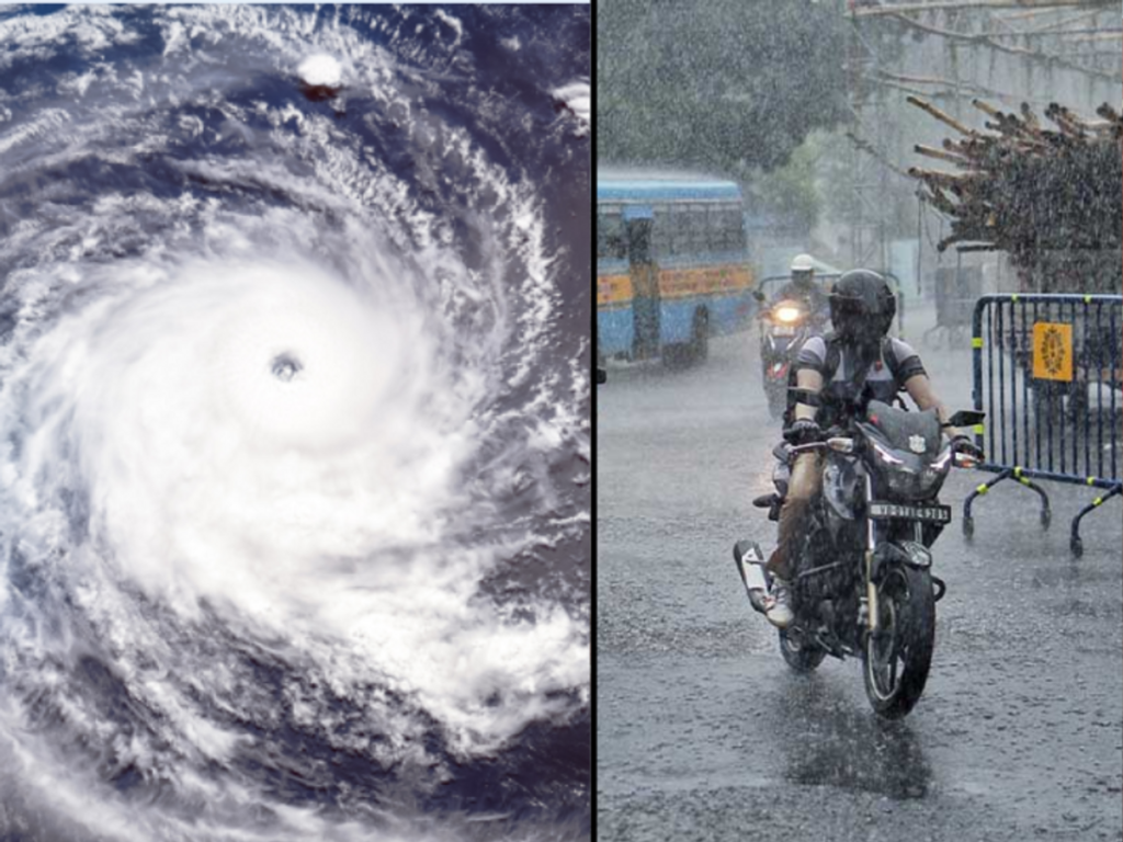
The Cyclonic Circulation over the Bay of Bengal has intensified weather activity by accelerating precipitation levels across the region. Meteorological observations indicate that the active upper-air cyclonic movements have strengthened atmospheric conditions favorable for rainfall, prompting close monitoring by weather authorities.
IMD Orange Warning Extended for Three Northern Districts Amid Active Weather Conditions
Cyclonic Circulation Strengthens Rainfall Activity Over the Bay of Bengal
The Cyclonic Circulation over the Bay of Bengal has become a key factor influencing weather conditions in the region. According to the available information, active upper-air cyclonic movements accelerated precipitation levels, leading to increased rainfall activity.
Meteorologists closely monitor upper-air circulations because they significantly influence cloud formation and rainfall patterns. Moreover, these atmospheric systems interact with moisture-laden winds to create conditions that support widespread precipitation.
The current cyclonic movement reflects the dynamic nature of the monsoon season. Consequently, weather agencies continue to observe the evolving system to assess its influence on regional weather patterns.
Although the available information confirms enhanced precipitation, authorities have not released additional details regarding specific rainfall impacts or district-level effects.
Cyclonic Circulation Influences Monsoon Weather Patterns
The Cyclonic Circulation plays an essential role in shaping monsoon weather across eastern and northeastern India. Upper-air cyclonic systems create areas of low atmospheric pressure that encourage moist air to rise, resulting in cloud development and rainfall.
Furthermore, the Bay of Bengal remains one of the primary sources of moisture during the southwest monsoon. When cyclonic circulations develop over the bay, they often transport abundant moisture toward nearby land areas.
Meteorological experts regularly evaluate these systems because they can influence rainfall intensity over several days. Therefore, continuous monitoring helps improve weather forecasting accuracy and supports timely public advisories.
The interaction between cyclonic circulation and seasonal monsoon winds also determines how rainfall spreads across different regions. As weather conditions evolve, authorities continue to analyze updated atmospheric data.
Cyclonic Circulation Supports Increased Precipitation Levels
The active Cyclonic Circulation has contributed to accelerated precipitation by strengthening atmospheric instability over the Bay of Bengal. This process encourages the formation of rain-bearing clouds and supports prolonged rainfall events.
Additionally, upper-air weather systems often influence rainfall distribution beyond coastal areas. Moisture transported inland can contribute to precipitation across neighboring states, particularly during the active phase of the monsoon.
Weather agencies rely on satellite observations, radar imagery, and atmospheric models to monitor these developments. Moreover, continuous data collection enables meteorologists to identify changes in the strength and movement of cyclonic systems.
Although increased precipitation has been observed, officials continue to evaluate the evolving weather pattern before issuing further assessments. Consequently, future forecasts will depend on updated meteorological observations.
Why Cyclonic Circulation Remains Important for Weather Forecasting
The Cyclonic Circulation remains one of the most important atmospheric features influencing seasonal weather forecasting. Accurate monitoring helps meteorologists predict rainfall intensity, cloud movement, and the potential duration of active weather conditions.
Moreover, understanding upper-air circulations supports disaster preparedness and resource planning during the monsoon season. Reliable forecasts enable local administrations to coordinate weather-related responses while informing the public about changing conditions.
Weather monitoring also contributes to agriculture, transportation, and water resource management. Therefore, continuous observation of cyclonic systems benefits multiple sectors that depend on accurate weather information.
The Bay of Bengal frequently generates weather systems that influence large parts of the Indian subcontinent. Similarly, ongoing analysis of upper-air circulations allows authorities to refine forecasts as atmospheric conditions change.
The current cyclonic movement demonstrates the importance of scientific weather monitoring throughout the active monsoon period.
Conclusion
The Cyclonic Circulation over the Bay of Bengal has accelerated precipitation levels by strengthening upper-air atmospheric activity. The active weather system continues to influence rainfall patterns and remains under close observation by meteorological authorities.
Furthermore, continuous monitoring of cyclonic movements enables weather agencies to improve forecasting accuracy and issue timely advisories. Scientific observations remain essential for understanding evolving atmospheric conditions during the monsoon season.
Overall, the Circulation highlights the crucial role of upper-air weather systems in shaping regional precipitation. As meteorologists continue to analyze the developing conditions, updated forecasts will provide greater clarity regarding the system’s future influence.
FAQs
1. What is Cyclonic Circulation?
Cyclonic Circulation refers to the rotating movement of air around a low-pressure area in the atmosphere, which often promotes cloud formation and rainfall.
2. Where did the Cyclonic Circulation develop?
According to the available information, the active upper-air cyclonic circulation developed over the Bay of Bengal.
3. How does it affect rainfall?
It enhances atmospheric instability, allowing moisture-rich air to rise and form rain-bearing clouds, thereby increasing precipitation levels.
4. Why do meteorologists monitor Cyclonic Circulation?
Meteorologists monitor these systems because they influence rainfall patterns, weather forecasts, and monsoon activity.
5. Has the Cyclonic Circulation caused increased precipitation?
Yes. Based on the available information, active upper-air cyclonic movements accelerated precipitation levels across the region.