


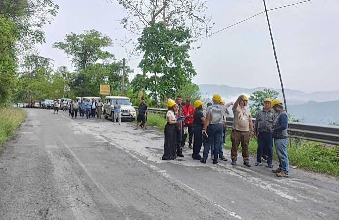
Aizawl smart road mapping is gaining importance as Mizoram expands the use of geospatial technology, remote sensing and landslide-monitoring systems to improve road safety in the state capital. Government agencies have already developed landslide hazard maps for Aizawl and are using LiDAR and satellite-based systems to study vulnerable slopes. These efforts aim to provide better information for planning, infrastructure protection and early warning.
The focus is particularly relevant because Aizawl’s steep terrain makes roads and settlements vulnerable to slope instability during heavy rainfall. Therefore, mapping vulnerable areas can help authorities identify locations that require closer monitoring, drainage improvements, slope protection or other preventive measures.
Arunachal Pradesh: Papum Pare Hosts Recipe Competition to Promote Nutrition During Poshan Maah 2026
Aizawl Smart Road Mapping Expands Landslide Assessment
Mizoram Remote Sensing Application Centre, or MIRSAC, has undertaken several projects involving landslide assessment and geospatial mapping. Its current projects include a Satellite Integrated Landslide Assessment Alert System, known as SILAAS, as well as a LiDAR survey of landslide-prone areas within Aizawl City.
LiDAR technology can generate detailed three-dimensional information about terrain. Consequently, it can help authorities examine slopes, elevation changes and other physical characteristics that may be difficult to assess through conventional mapping alone.
MIRSAC has also previously completed landslide hazard zonation mapping for Aizawl City. The centre’s completed-project records show that the work formed part of wider disaster-risk and environmental mapping initiatives in Mizoram.
Furthermore, the centre has worked on hazard mapping at different scales across Mizoram. These projects provide geospatial information that can support planning and disaster-management decisions.
Such mapping does not itself prevent a landslide. However, it can provide authorities with better information about where risks may be concentrated and where preventive action deserves greater attention.
Radar and Remote Sensing Strengthen Slope Monitoring
Advanced remote-sensing technologies can complement conventional field inspections. Satellite observations can cover large and difficult-to-access areas, while detailed terrain surveys can provide information about individual slopes and infrastructure corridors.
Mizoram’s SILAAS project represents an effort to use satellite-based information for landslide assessment and alerts. The system forms part of MIRSAC’s ongoing geospatial work and reflects the state’s broader move toward technology-supported disaster management.
At the same time, the state’s disaster-management authorities are working with the Geological Survey of India on an Experimental Regional Landslide Early Warning System. The collaboration aims to validate the system for operational use in Mizoram and establish standard procedures for distributing landslide forecasts and warnings.
Therefore, remote sensing and early-warning technology can work together. Mapping can identify vulnerable terrain, monitoring can track changing conditions, and warning systems can communicate risks when defined thresholds indicate potential danger.
This layered approach becomes especially important in mountainous areas, where road conditions and slope stability can change rapidly during periods of intense rainfall.
PWD Road Infrastructure Faces Mountain Terrain Challenges
The Public Works Department remains central to protecting and maintaining Mizoram’s road network. The state government has reported extensive road construction, upgrading and protection work through the PWD.
Recent government information records more than 203 kilometres of roads upgraded with blacktop surfacing and more than 75 kilometres of high-strength concrete roads. It also reports hundreds of cross-drainage structures and more than 10,000 running metres of protection works intended to safeguard roads and infrastructure from erosion and environmental impacts.
These measures matter because uncontrolled water flow can contribute to road damage and slope instability. Cross-drainage structures can help manage water movement, while protection works can strengthen vulnerable sections of infrastructure.
The PWD is also undertaking specific road projects addressing rockfall risks. A 2026 tender from the Ministry of Road Transport and Highways, involving the Mizoram PWD’s highway division, covers special repairs on NH-108/44A described as a rockfall bypass between specified sections of the highway.
Consequently, technological mapping and physical road engineering form complementary parts of infrastructure protection.
Aizawl’s Landslide Risk Requires Continuous Monitoring
Aizawl has a long history of landslide-related hazards. Mizoram’s State Disaster Management Plan records several significant landslide and land-subsidence events in and around the city, including incidents affecting roads and residential areas.
The city’s authorities have therefore developed policies specifically addressing landslide and slope-management risks. Aizawl Municipal Corporation established a Landslide Policy Committee, while site-development and slope-modification regulations were subsequently notified.
The Aizawl Hazard Map, prepared through earlier technical work, was approved by the municipal corporation in 2017. The city’s landslide-management framework also calls for monitoring existing landslides and developing the capacity to monitor potentially unsafe slopes.
Moreover, the existing Roadmap to Stability recommends landslide monitoring and early-warning measures involving meteorological and geotechnical information. It also highlights the need for sensor equipment and systematic collection of geological and soil data.
These measures show that Aizawl’s approach to landslide risk has developed over several years. The latest use of advanced mapping technologies can add new data to this established framework.
Smart Mapping Can Support Better Road Planning
The value of Aizawl smart road mapping extends beyond emergency response. Detailed terrain information can support decisions about where roads should be upgraded, where drainage requires improvement and which areas may need additional slope protection.
For example, identifying vulnerable slopes before major construction can help engineers consider terrain conditions during project planning. Similarly, mapping can help authorities prioritise maintenance on existing roads where instability presents a greater risk.
The approach can also support coordination between different government agencies. MIRSAC provides geospatial expertise, while the PWD manages road infrastructure and disaster-management authorities coordinate emergency preparedness. Consequently, shared mapping information can help different departments work from a common understanding of local hazards.
Aizawl’s district disaster-management branch also operates a disaster-management control room and handles reports involving landslides and other natural calamities.
Therefore, the usefulness of smart mapping ultimately depends on how effectively technical information reaches decision-makers and emergency-response agencies.
Technology Supports Long-Term Mountain Road Resilience
Mizoram’s mountainous geography means that road resilience will remain a long-term infrastructure priority. Heavy rainfall, erosion, rockfall and slope instability can affect transport links and increase maintenance requirements.
The state government’s infrastructure programme includes both road strengthening and protection measures. At the same time, MIRSAC’s continuing work on LiDAR surveys and satellite-based landslide assessment provides a technological layer to the state’s preparedness system.
However, technology works best when authorities combine it with field verification, engineering interventions and effective early-warning procedures. A map can identify a vulnerable area, but engineers and administrators still need to determine what action the location requires.
Similarly, early-warning systems need reliable data, trained personnel and clear communication procedures. The current collaboration with the Geological Survey of India specifically includes developing standard operating procedures for information flow and warning dissemination.
As a result, Mizoram’s evolving approach combines mapping, monitoring, engineering and disaster preparedness rather than relying on a single technology.
Conclusion
Aizawl smart road mapping reflects Mizoram’s expanding use of geospatial technology to understand and manage landslide risks affecting roads and urban areas. MIRSAC’s LiDAR survey of landslide-prone parts of Aizawl and its Satellite Integrated Landslide Assessment Alert System add important technological capabilities to the state’s existing hazard-mapping framework.
At the same time, the PWD continues road protection, drainage and strengthening works, while disaster-management authorities are developing stronger landslide early-warning arrangements with technical agencies.
The combination of detailed mapping, satellite observation, field assessment and physical infrastructure improvements can support more informed road planning and disaster preparedness. However, sustained monitoring and timely preventive action will remain essential for improving the resilience of Aizawl’s mountain road network.
FAQs
What is Aizawl smart road mapping?
Aizawl smart road mapping refers to the use of geospatial technologies such as LiDAR, satellite-based systems and hazard mapping to understand terrain and support safer road and infrastructure planning.
Is LiDAR being used to study Aizawl’s landslide-prone areas?
Yes. MIRSAC lists a LiDAR survey of landslide-prone areas within Aizawl City among its ongoing projects.
How can smart mapping help prevent road disruptions?
Mapping can identify vulnerable slopes and terrain conditions, allowing authorities to prioritise monitoring, drainage, protection works and maintenance. It cannot eliminate landslide risk on its own.
What other landslide technology is being developed in Mizoram?
Mizoram is working with the Geological Survey of India on an Experimental Regional Landslide Early Warning System aimed at improving landslide forecasting and warning procedures.
Why is landslide monitoring important for Aizawl?
Aizawl’s mountainous terrain and history of landslides make continuous monitoring important for protecting roads, buildings and other infrastructure. The city’s authorities have developed dedicated hazard maps and slope-management measures for this purpose.