


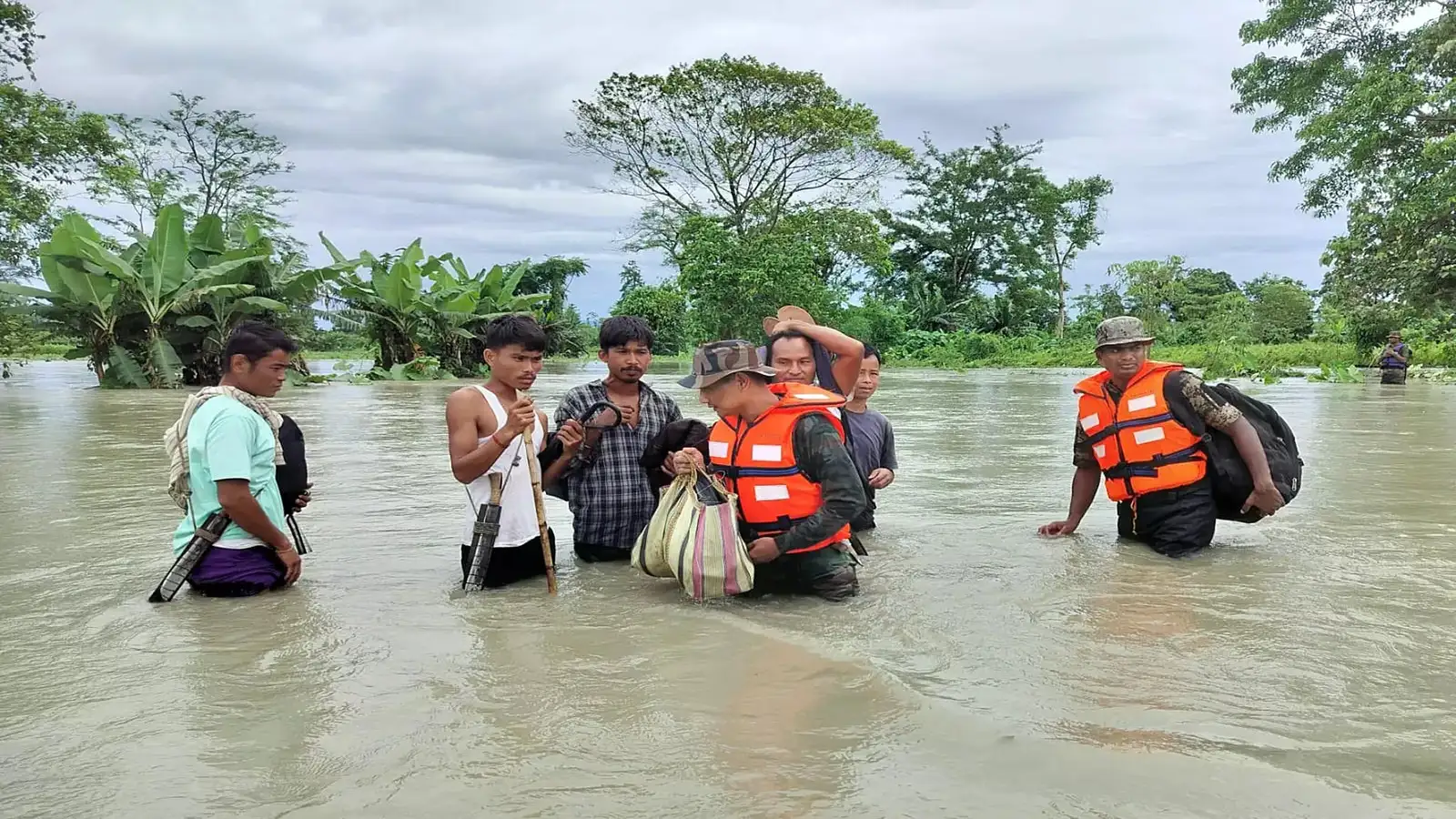
The Arunachal Aerial Flood Assessment was carried out by state authorities to evaluate the impact of recent floods across affected districts. Moreover, the aerial survey enabled officials to assess flood damage, identify isolated areas, and review the progress of ongoing rescue and relief operations. Consequently, the assessment will help authorities prioritize relief distribution, infrastructure restoration, and future disaster management planning.
Mizoram Accelerates Bamboo Processing Plan to Boost Climate-Resilient Industries
Assam Forest Department Deploys AI for Flood Monitoring in Kaziranga National Park
Arunachal Aerial Flood Assessment Reviews Flood Impact
The Arunachal Aerial Flood Assessment provided authorities with a comprehensive overview of flood-affected regions through aerial observation. Furthermore, officials examined inundated villages, damaged infrastructure, swollen rivers, and transportation networks to determine the extent of the disaster.
Aerial assessments allow emergency agencies to access information from areas that may remain inaccessible by road. Consequently, they support faster evaluation of conditions on the ground.
Moreover, the survey helps identify locations requiring immediate humanitarian assistance. Therefore, relief efforts can be directed more efficiently.
Additionally, real-time aerial observations improve situational awareness during emergencies. Thus, authorities can make better-informed operational decisions.
Survey Supports Rescue and Relief Operations
The Arunachal Aerial Flood Assessment plays an important role in strengthening disaster response by providing updated information to emergency agencies. Furthermore, officials reviewed the deployment of rescue teams, relief camps, and essential supply routes during the survey.
Accurate field assessments improve the effectiveness of disaster management operations. Consequently, authorities can allocate personnel and resources where they are most needed.
Moreover, coordination among disaster response agencies enhances operational efficiency. Therefore, rescue and relief activities continue under close supervision.
Similarly, aerial monitoring supports faster identification of emerging challenges. Additionally, timely assessments improve overall emergency preparedness.
Infrastructure Damage and Connectivity Evaluated
The Arunachal Aerial Flood Assessment also focused on reviewing the condition of roads, bridges, public utilities, and other critical infrastructure affected by the floods. Furthermore, engineers and administrative officials will use the survey findings to plan restoration work and restore connectivity.
Floods can significantly damage transportation networks in mountainous regions. Consequently, infrastructure inspections remain a priority following major rainfall events.
Moreover, restoration planning depends on accurate assessments of damaged assets. Therefore, technical teams continue evaluating affected locations.
Similarly, rebuilding resilient infrastructure can reduce future disaster risks. Additionally, coordinated planning supports faster recovery for affected communities.
Disaster Preparedness Remains a Long-Term Priority
The Arunachal Aerial Flood Assessment highlights the importance of integrating modern monitoring methods into disaster management strategies. Furthermore, aerial surveys, weather forecasting, and early warning systems contribute to more effective emergency planning.
Comprehensive disaster preparedness helps reduce the impact of future floods. Consequently, authorities continue investing in technologies and response mechanisms that improve resilience.
Moreover, collaboration among government departments and emergency agencies strengthens disaster management capabilities. Therefore, long-term planning remains essential for protecting lives and infrastructure.
Similarly, community awareness and preparedness programmes support effective emergency response. Additionally, resilient infrastructure and continuous monitoring improve disaster readiness across the state.
Conclusion
The Arunachal Aerial Flood Assessment has provided state authorities with valuable information on flood-affected areas, damaged infrastructure, and ongoing rescue operations. Moreover, the survey will assist in prioritizing relief measures, restoring connectivity, and strengthening disaster response efforts.
Furthermore, continued monitoring, coordinated relief operations, and investment in resilient infrastructure will remain essential as Arunachal Pradesh recovers from the recent floods. Consequently, the Arunachal Aerial Flood Assessment represents an important step toward improving emergency management and long-term disaster preparedness across the state.
FAQs
1. What is the Arunachal Aerial Flood Assessment?
It is an aerial survey conducted by authorities to evaluate flood damage, assess affected areas, and support disaster response planning.
2. Why was the aerial assessment conducted?
The survey helped officials identify flood-affected regions, assess infrastructure damage, and monitor rescue and relief operations.
3. How does an aerial survey help during floods?
It provides rapid information about inaccessible areas, helping authorities allocate resources and prioritize emergency assistance.
4. What will authorities do after the assessment?
The findings will support relief distribution, infrastructure restoration, and long-term disaster management planning.
5. Why is the Arunachal Aerial Flood Assessment significant?
It improves disaster response by providing accurate situational awareness, strengthening relief operations, and supporting future flood preparedness.