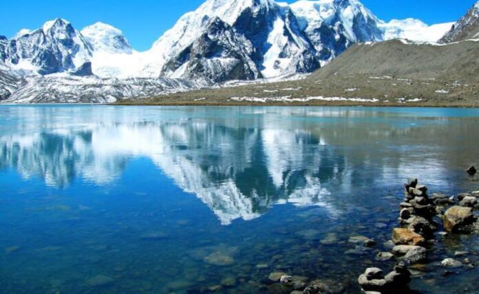
Recent surveys of glacial lakes in Arunachal Pradesh and Sikkim, regions bordering China, have been launched to assess potential risks posed by these lakes. Glacial lakes, formed by the melting of glaciers, are highly vulnerable to climate change. In the wake of recent glacier-related disasters worldwide, the Indian government has ramped up efforts to monitor and manage glacial lakes in its border regions to prevent catastrophic events like Glacial Lake Outburst Floods (GLOFs).
Understanding Glacial Lakes and Their Risks
Glacial lakes are bodies of water that form in depressions or valleys as glaciers melt. Over the past few decades, the number and size of glacial lakes have increased significantly due to rising global temperatures. This has raised concerns about the stability of these lakes and the risk of GLOFs, which occur when the natural dam containing the lake fails. Key risks associated with glacial lakes include:
- Flooding: GLOFs can result in sudden, catastrophic floods, causing massive damage to downstream areas, including loss of lives, destruction of infrastructure, and displacement of communities.
- Landslides: The increased water volume and pressure from glacial lakes can trigger landslides, further destabilizing the region.
- Cross-Border Impact: Given their proximity to international borders, any disasters involving these lakes could have cross-border implications, affecting diplomatic relations and regional stability.
Significance of Glacial Lake Surveys in Arunachal Pradesh and Sikkim
The recent glacial lake surveys conducted in Arunachal Pradesh and Sikkim are part of a broader initiative to understand and mitigate the risks posed by these lakes in the Himalayan region. The surveys aim to:
- Monitor Lake Stability: By examining the current state of glacial lakes, scientists can assess their stability and predict potential failures or outburst events.
- Develop Early Warning Systems: Data from these surveys will help in developing early warning systems for GLOFs, which can provide critical time for evacuation and disaster preparedness.
- Inform Policy and Infrastructure Planning: The findings from these surveys will inform government policies on climate resilience and guide the development of infrastructure in these vulnerable areas.
Key Areas of Focus in the Surveys
The glacial lake surveys in Arunachal Pradesh and Sikkim are being carried out using advanced technologies, including satellite imagery, drones, and remote sensing techniques. Some key areas of focus include:
- Mapping Lake Locations and Sizes: Detailed mapping of glacial lakes to track their expansion and identify new formations due to glacial melt.
- Assessing Moraine Stability: Evaluating the stability of moraines, which are natural dams formed from glacial debris, to determine their likelihood of failure.
- Hydrological and Geophysical Studies: Conducting studies to understand the hydrology of the lakes, their water volume, and pressure levels, and the geophysical characteristics of the surrounding terrain.
Strategic Importance of Monitoring Glacial Lakes in Border Regions
The glacial lakes in Arunachal Pradesh and Sikkim hold significant strategic importance due to their proximity to the India-China border. Monitoring these lakes is crucial for several reasons:
- National Security: Any sudden glacial lake outburst could affect border security by damaging infrastructure, including roads and bridges that are vital for troop movement and supply chains.
- Disaster Preparedness: Ensuring the safety of local communities and the Indian Army stationed in these remote regions is critical, especially given the challenging terrain and limited access to immediate rescue services.
- Regional Stability: Collaborative efforts with neighboring countries, including China, in monitoring and managing shared glacial resources can enhance regional stability and foster cooperation in disaster risk reduction.
Government Initiatives and Future Directions
The Indian government, in collaboration with state governments and scientific agencies, has taken several initiatives to monitor and manage glacial lakes in the Himalayan region. These include:
- Strengthening Monitoring Networks: Expanding the network of automated weather stations and remote sensing equipment to enhance real-time monitoring capabilities.
- Research and Collaboration: Encouraging research collaborations between Indian institutions and international agencies to develop comprehensive glacial risk assessment models.
- Community Awareness and Preparedness: Conducting community awareness programs and training local populations in disaster preparedness and response strategies.
The recent glacial lake surveys in Arunachal Pradesh and Sikkim represent a proactive approach by the Indian government to mitigate the risks associated with climate change in its border regions. By closely monitoring these glacial lakes and developing early warning systems, India aims to prevent potential disasters and ensure the safety of its citizens and infrastructure. The strategic importance of these initiatives cannot be overstated, as they not only safeguard national security but also promote regional cooperation in addressing shared environmental challenges. As the effects of climate change continue to unfold, such efforts are crucial for building resilience and protecting vulnerable communities in the Himalayas.


