
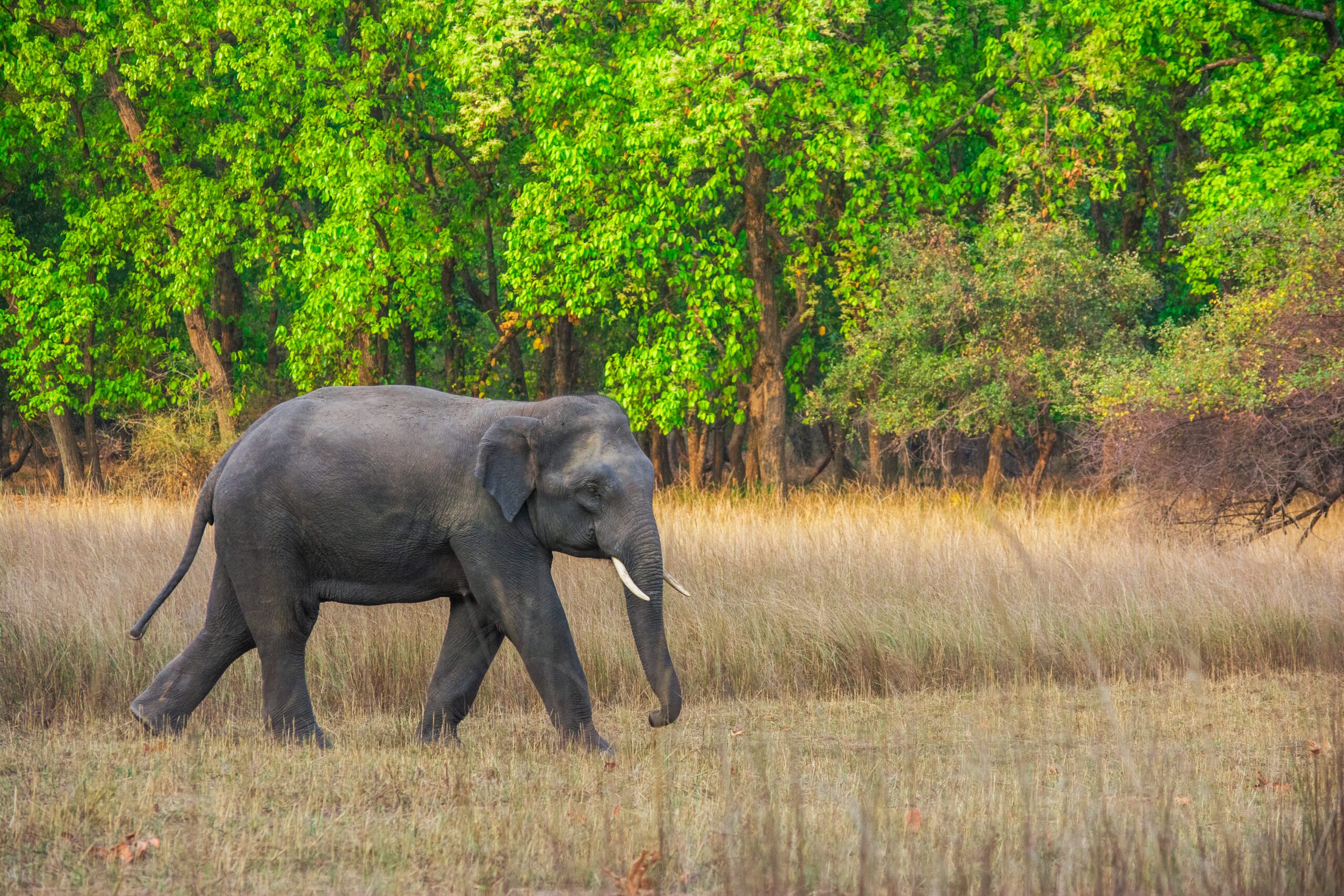
The Assam Forest Department has begun using high-resolution satellite imagery to monitor and track elephant migration paths across key wildlife corridors in the state. The initiative aims to improve conservation efforts, reduce human-elephant conflicts, and strengthen scientific wildlife management. Moreover, officials stated that advanced geospatial technologies are helping authorities understand seasonal movement patterns and habitat connectivity. The development highlights Assam’s growing focus on integrating technology with biodiversity conservation.
Manipur State Museum Begins Digital Restoration of Royal Centuries-Old Scripts and Manuscripts
Sikkim Governor Flags Off the First Official Batch of Pilgrims for the Kailash Mansarovar Yatra
Satellite Technology Enhances Wildlife Monitoring Efforts
Assam forest department uses high-resolution satellite imagery to track elephant migration paths, enabling conservation teams to gather more accurate information about the movement of wild elephants. Consequently, authorities are expected to improve habitat management and corridor protection.
The high-resolution imagery provides valuable insights into forest cover, migration routes, and changes in natural landscapes. Moreover, experts can analyze the data to identify areas vulnerable to habitat fragmentation. Therefore, conservation strategies can be implemented more effectively.
Officials emphasized that scientific monitoring is essential for protecting elephant populations and maintaining ecological balance. Furthermore, technological advancements are helping improve the precision of wildlife studies. As a result, decision-making processes are becoming more data-driven.
Meanwhile, forest personnel are coordinating with researchers and technical agencies. Consequently, monitoring capabilities are being strengthened across sensitive regions.
Reducing Human-Elephant Conflict Through Data Analysis
Assam forest department uses high-resolution satellite imagery to track elephant migration paths with the objective of minimizing encounters between wildlife and human settlements. Moreover, conflicts involving elephants often result in damage to crops and property. Therefore, understanding movement patterns has become increasingly important.
The collected information can help authorities anticipate migration periods and take preventive measures. Consequently, local communities may receive timely warnings and support. Such efforts contribute to safer coexistence between humans and wildlife.
Furthermore, identifying critical corridors allows conservation agencies to focus protection measures in ecologically sensitive zones. As a result, disruptions to elephant habitats may be reduced.
Meanwhile, awareness campaigns are being conducted to educate communities about conservation practices. Similarly, collaboration with local stakeholders is being encouraged.
Strengthening Conservation and Habitat Management
The Assam forest department uses high-resolution satellite imagery to track elephant migration paths as part of broader efforts to strengthen wildlife conservation. Moreover, preserving habitat connectivity is crucial for the survival of elephant populations. Therefore, protecting migration corridors remains a priority.
Officials highlighted that geospatial technologies can improve ecosystem management and support biodiversity preservation. Consequently, authorities are expected to formulate more effective conservation plans. Such measures contribute to sustainable environmental management.
Furthermore, long-term monitoring can provide valuable information about the effects of climate change and human activities on wildlife. As a result, adaptive conservation strategies may be developed.
Meanwhile, partnerships with scientific institutions and environmental organizations are being expanded. Similarly, research initiatives are receiving increased support.
Promoting Technology-Driven Environmental Protection
The initiative reflects Assam’s commitment to utilizing modern technologies for ecological conservation. Moreover, digital tools are transforming the way natural resources are monitored and managed. Therefore, investments in technology-based solutions are becoming increasingly significant.
Officials stated that integrating satellite imagery with field observations will strengthen wildlife protection mechanisms. Consequently, conservation efforts are expected to become more effective and efficient. Such approaches support sustainable development and environmental stewardship.
Furthermore, authorities are exploring additional applications of remote sensing technologies. As a result, broader ecosystem monitoring capabilities may be enhanced.
Meanwhile, training programs for forest personnel are being strengthened. Similarly, advanced data management systems are being introduced.
Conclusion
Assam forest department uses high-resolution satellite imagery to track elephant migration paths, marking an important advancement in wildlife conservation and ecological management. Moreover, the initiative is expected to improve habitat protection and reduce human-elephant conflicts.
The use of modern technology highlights the importance of scientific approaches in preserving biodiversity. Therefore, it represents a significant step toward sustainable conservation practices in Assam.
As the Assam forest department uses high-resolution satellite imagery to track elephant migration paths, the effort underscores the role of innovation in ensuring the long-term protection of wildlife and natural ecosystems.
FAQs
1. What technology is being used by the Assam Forest Department?
High-resolution satellite imagery is being used to track elephant migration routes.
2. Why is tracking elephant movement important?
It helps protect habitats and reduce human-elephant conflicts.
3. How does satellite imagery assist conservation?
It provides accurate data on migration paths and habitat conditions.
4. What are wildlife corridors?
They are routes used by animals to move between habitats.
5. How will local communities benefit from this initiative?
Improved monitoring can help provide early warnings and reduce conflicts.