


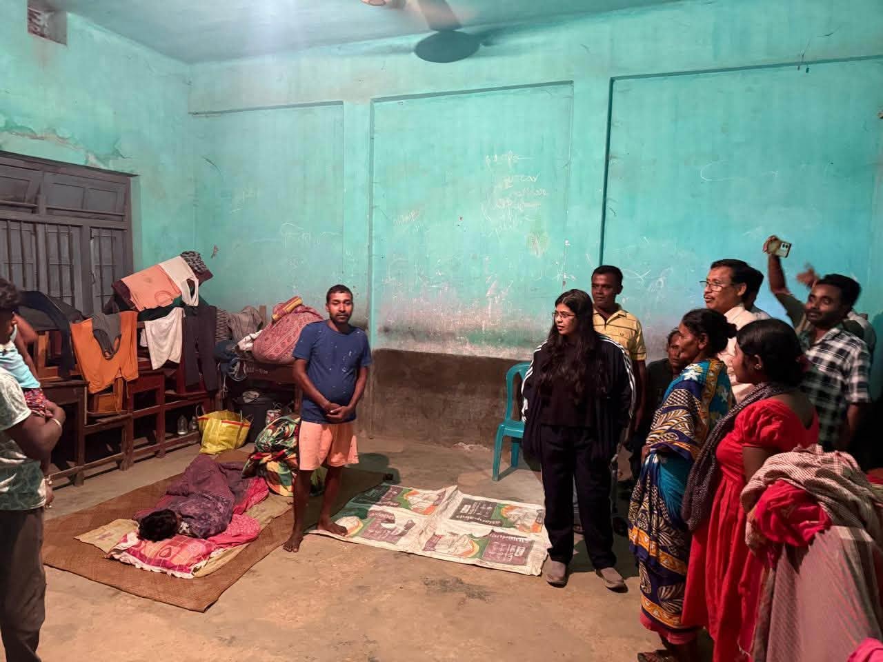
Continuous heavy rainfall has disrupted normal life across Tripura, forcing 10,905 people from 2,787 families to take shelter in 78 relief camps. According to the State Emergency Operation Centre (SEOC), flooding, landslides, and house damage have affected several districts, particularly Unakoti, Khowai, and Dhalai.
Authorities have also reported rising river levels, damaged roads, and widespread destruction of homes. Rescue and restoration work is underway, while the India Meteorological Department (IMD) has warned of more heavy rainfall over the next 24 hours.
Read More: Central Team Assesses East Siang Flood Damage
Key Facts
- State: Tripura
- Report Issued By: State Emergency Operation Centre (SEOC)
- Report Time: 5 PM, Thursday
- Relief Camps: 78
- Affected Families: 2,787
- People in Relief Camps: 10,905
- Worst-Hit Districts: Unakoti, Khowai and Dhalai
- Damaged Houses: 862
- Fully Damaged Houses: 64
- Severely Damaged Houses: 93
- Partially Damaged Houses: 717
- Highest Rainfall: Kumarghat – 145.5 mm
- Fatalities (July 1–9): One drowning death
- Weather Alert: IMD warns of more heavy rainfall
Heavy Rain Disrupts Life Across Tripura
Continuous heavy rainfall has caused widespread flooding across several parts of Tripura. Moreover, overflowing rivers, waterlogging, and landslides have affected thousands of residents.
According to the latest Detailed Daily Situation Report (DSR) issued by the State Emergency Operation Centre (SEOC), authorities have opened 78 relief camps across the state. These camps are currently sheltering 10,905 people from 2,787 affected families.
Unakoti, Khowai and Dhalai Among Worst-Hit Districts
The worst-affected districts include Unakoti, Khowai, and Dhalai, where heavy rainfall flooded low-lying areas and forced many families to leave their homes.
Furthermore, Unakoti district has established 35 relief camps accommodating 4,068 people. Khowai is operating 22 camps with 2,844 inmates, while Dhalai has opened 20 camps housing 1,913 people. North Tripura is running one relief camp with 80 displaced residents.
Hundreds of Houses Damaged
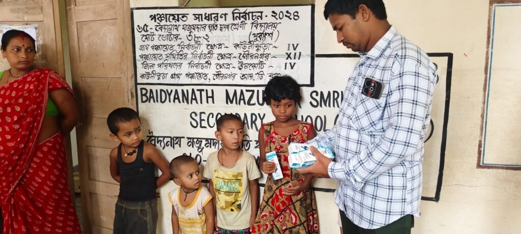
The SEOC reported damage to 862 houses due to continuous rainfall.
Among them, 64 houses were completely destroyed, 93 suffered severe damage, and 717 sustained partial damage. Additionally, Longtharai Valley subdivision in Dhalai district recorded the highest destruction, with all 64 fully damaged houses located in the subdivision.
Officials are continuing damage assessments. Afterward, eligible families will receive financial assistance according to government guidelines.
Landslides Affect Road Connectivity
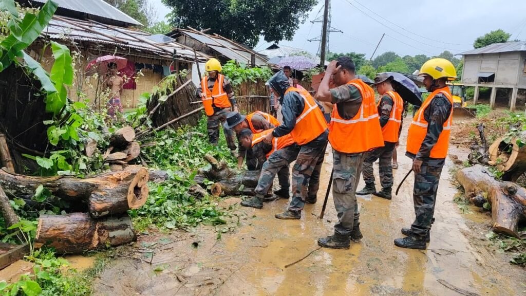
Heavy rain also triggered several landslides in different districts.
Authorities reported landslides at 18 Mura–36 Mile under Mungiakami Block in Khowai district, Natun Chan Bari–Dasgaria Road under Ratanpur VC, and Tirthamukh–Nuncherra Road in Gomati district’s Karbook subdivision.
However, the SDRF, Public Works Department (PWD), Civil Defence Volunteers, and local residents cleared the debris quickly and restored traffic. Teams also removed fallen trees that had blocked roads in Mungiakami.
River Levels Continue to Rise
Several rivers are flowing above safe levels, increasing the flood risk.
The Manu River at Kailashahar is flowing above the danger level. Meanwhile, the Khowai River at Khowai, Manu River at Longtharai Valley, and Deo River at Kumarghat remain above their critical levels.
The Howrah, Juri, Bijoy, and Kakri rivers are also flowing at or above expected flood levels. However, the Gomati River at Udaipur, Amarpur, and Sonamura remains below expected flood levels.
Kumarghat Records Highest Rainfall
Rainfall remained intense across several districts during the past 24 hours.
Kumarghat recorded the highest rainfall at 145.5 mm. It was followed by Khowai (140.4 mm), Chhamanu (134.2 mm), Nidebi (128.4 mm), Amarpur (119.6 mm), Kailashahar (110.8 mm), Tulashikhar (110.4 mm), Sabroom (109 mm), and Teliamura (106 mm).
IMD Issues Fresh Rain Warning
The cumulative disaster report from July 1 to July 9 recorded one drowning death. Fortunately, authorities reported no additional deaths or injuries in the latest update.
Meanwhile, the India Meteorological Department (IMD) has forecast light to moderate rainfall across most parts of Tripura during the next 24 hours. It has also warned of heavy rainfall between 7 cm and 11 cm at isolated locations.
Authorities have advised people living in flood-prone and landslide-prone areas to remain alert, follow official advisories, and avoid unnecessary travel during periods of heavy rainfall.
Questions and Answers
Q: What is the current flood situation in Tripura?
A: Heavy rainfall has affected several districts, forcing 10,905 people to stay in 78 relief camps.
Q: Which districts are the worst affected?
A: Unakoti, Khowai, and Dhalai have reported the highest impact.
Q: How many houses have been damaged?
A: Authorities have reported damage to 862 houses, including 64 fully destroyed homes.
Q: Which rivers are above danger or critical levels?
A: The Manu River at Kailashahar is above the danger level, while the Khowai, Manu (Longtharai Valley), and Deo rivers are above critical levels.
Q: What has the IMD forecast?
A: The IMD has predicted light to moderate rainfall across Tripura, along with heavy rainfall at isolated places over the next 24 hours.
Location Context
Tripura, located in Northeast India, experiences intense monsoon rainfall every year. The state’s hilly terrain, numerous rivers, and low-lying settlements make it vulnerable to floods and landslides. Timely disaster response, river monitoring, and relief operations are essential to protect lives and restore normalcy during the monsoon season.
Also Read: Tripura Business Conclave Draws ₹4,000 Crore Interest