


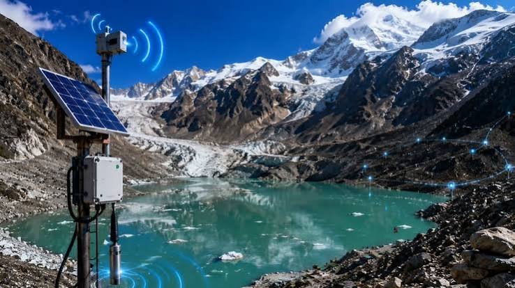
Sikkim GLOF monitoring systems are receiving a major technology upgrade as the state strengthens surveillance and early-warning capabilities around vulnerable glacial lakes. Recent measures include satellite-linked monitoring, automated weather stations, water-level sensors and advanced scientific assessments. Moreover, Sikkim has identified 40 high-hazard glacial lakes, including 16 classified as Category A, highlighting the need for continuous monitoring and preparedness.
The latest developments build on technology already deployed in the state and new scientific initiatives undertaken during 2026. In July, an indigenous glacial-lake monitoring technology suite developed by C-DAC under MeitY was handed over to the Government of Sikkim. The system is designed to support autonomous profiling and risk assessment of vulnerable glacial lakes.
Arunachal Pradesh: Papum Pare Hosts Recipe Competition to Promote Nutrition During Poshan Maah 2026
Sikkim GLOF Monitoring Strengthens Early Warning Systems
The state’s approach combines satellite-based observation with ground-level sensors. C-DAC’s existing GLOF early-warning system uses water-level sensors at Shako Chho, with near-real-time data transmitted through the INSAT satellite system to a control centre in Gangtok. The system also supports flood simulations and inundation analysis.
Meanwhile, the Sikkim State Disaster Management Authority has installed automated weather stations at South Lhonak and Sako Chu in North Sikkim. These stations continuously monitor parameters such as temperature, precipitation and water levels and transmit information to a central monitoring system.
Therefore, the monitoring network provides officials with multiple sources of information rather than relying on a single observation system. Weather measurements, lake-level changes and scientific assessments can collectively help authorities understand changing conditions around vulnerable lakes.
The system also supports early-warning planning. If monitoring indicates a developing hazard, authorities can use the available information alongside established emergency mechanisms to assess risks and communicate warnings.
High-Risk Lakes Receive Greater Scientific Attention
Sikkim’s disaster-management authorities have increased scientific attention on high-risk glacial lakes following the devastating South Lhonak GLOF in 2023. The state government now treats scientific assessment, monitoring and mitigation planning as major components of its disaster-preparedness strategy.
In August 2026, the Department of Science and Technology completed a multidisciplinary expedition to high-risk glacial lakes in Mangan district. The team collected bathymetric, geological, geophysical, hydrological, geomorphological and meteorological data to support long-term risk assessment and mitigation planning.
Furthermore, researchers used techniques including Electrical Resistivity Tomography, bathymetric surveys, DGPS measurements and hydrological observations. A meteorological monitoring station was also deployed at Kerang and Goma Chhu during the expedition.
These investigations can provide detailed baseline information about vulnerable lake systems. Consequently, authorities can use the findings for hydrodynamic modelling, hazard mapping and the preparation of lake-specific mitigation plans.
Satellite Technology Adds Another Layer of Surveillance
Remote sensing and satellite imagery play an important role in monitoring changes in glacial lakes. Sikkim officials have highlighted the usefulness of satellite imagery for tracking changes in lake size and extent, particularly in remote Himalayan locations where regular physical access remains difficult.
The indigenous technology suite handed over to Sikkim in June 2026 represents another step toward expanding technological capabilities within the state. C-DAC developed the system through research supported by MeitY, with the technology subsequently transferred to the Department of Science and Technology, Government of Sikkim.
Moreover, satellite-linked telemetry can help transmit information from difficult-to-access areas to monitoring centres. Earlier GLOF systems in Sikkim already demonstrated the use of satellite communication for transmitting sensor data from glacial lakes.
This combination of satellite observation and ground sensors is particularly important in high-altitude environments. Officials cannot depend entirely on frequent physical inspections, so remote monitoring can provide additional information between field expeditions.
At the same time, satellite data works alongside field observations rather than replacing them. Recent expeditions show that Sikkim continues to combine remote sensing with direct scientific measurements and high-altitude investigations.
Coordination Becomes Central to GLOF Preparedness
Sikkim’s latest preparedness efforts involve several state and central agencies. A high-level coordination meeting chaired by Chief Secretary R. Telang on September 10 reviewed scientific assessments, early-warning mechanisms, mitigation measures and inter-agency coordination related to GLOF risks.
The meeting brought together state departments, central agencies, defence organisations, technical institutions and project developers. Discussions included the early-warning network, hydrological monitoring, telemetry systems, flood forecasting and warning dissemination.
The state has also identified Shako Chho as one of its 16 Category A high-risk glacial lakes. Officials have examined its characteristics and considered different mitigation options, while early-warning systems remain a key component of the preparedness strategy.
Furthermore, the Department of Science and Technology has been designated as the nodal department for GLOF hazard assessment and risk-mitigation studies in Sikkim. The department is working through an interdisciplinary approach involving other government agencies and technical institutions.
Such coordination matters because GLOF risk extends beyond the immediate lake area. A major flood can affect downstream settlements, roads, bridges, hydropower infrastructure and other critical assets. Therefore, monitoring must connect directly with forecasting, warning dissemination and emergency preparedness.
Sikkim GLOF Monitoring Supports Long-Term Risk Reduction
The expansion of Sikkim GLOF monitoring systems represents a shift toward more technology-driven disaster preparedness in the Himalayan state. Instead of focusing only on emergency response, authorities are increasingly investing in continuous observation, scientific modelling and advance risk assessment.
The state is also developing lake-specific mitigation proposals. Recent assessments have covered the Shako Chho Lake, Lhonak Valley and Gurudongmar complexes, while authorities are working on early-warning arrangements for priority locations.
National programmes are supporting this wider effort. Under the National Glacial Lake Risk Mitigation Programme, Sikkim received an approved central share for projects involving scientific inventories, high-risk lake identification, early-warning systems and automated weather stations.
However, technology alone cannot eliminate GLOF risk. Monitoring systems need regular maintenance, reliable communication networks, trained personnel and clear procedures for interpreting warnings. Additionally, communities downstream need effective warning and evacuation arrangements.
Therefore, the combination of advanced telemetry, satellite observation, scientific fieldwork and coordinated disaster planning will remain important as Sikkim works to strengthen resilience against future glacial hazards.
Conclusion
Sikkim GLOF monitoring systems are becoming increasingly sophisticated as authorities combine satellite technology, telemetry, automated weather stations, water-level sensors and scientific field investigations. The state’s identification of 40 high-hazard glacial lakes, including 16 Category A lakes, has reinforced the importance of continuous surveillance and preparedness.
The indigenous monitoring technology transferred to Sikkim in 2026 adds another capability to the state’s disaster-management infrastructure. Meanwhile, recent scientific expeditions and coordination meetings are helping authorities develop stronger risk assessments and lake-specific mitigation plans.
Ultimately, effective GLOF preparedness will depend on connecting technology with timely warnings, scientific interpretation, inter-agency coordination and community readiness. Sikkim’s expanding monitoring network provides an important foundation for that long-term effort.
FAQs
What is Sikkim GLOF monitoring?
Sikkim GLOF monitoring involves observing vulnerable glacial lakes using satellite technology, water-level sensors, automated weather stations, scientific surveys and early-warning systems.
How does satellite telemetry help Sikkim?
Satellite telemetry allows data from remote monitoring locations to reach control centres, helping officials track lake and weather conditions in difficult-to-access Himalayan areas.
How many high-hazard glacial lakes has Sikkim identified?
Sikkim has identified 40 high-hazard glacial lakes, of which 16 are classified as Category A, according to the state’s Department of Science and Technology.
What technology is used for GLOF monitoring?
The systems include satellite imagery, satellite-linked telemetry, water-level sensors, automated weather stations, bathymetric surveys, hydrological monitoring and hydrodynamic modelling.
Why is Sikkim GLOF monitoring important?
Continuous monitoring can provide scientific information for early-warning systems, risk assessment and mitigation planning, helping authorities prepare downstream communities and critical infrastructure for potential glacial-lake hazards.